A folder of construction photos on someone's phone is not documentation. It's evidence of nothing — no date a bank can trust, no location a client can verify, no way to tell which photo belongs to which stage of work. And yet that's exactly how most small and mid-size Philippine contractors submit progress proof: a batch of images forwarded over Viber, metadata stripped the moment they pass through the app.
That gap matters most at two moments: when a bank is deciding whether to release the next construction loan tranche, and when a client is deciding whether to pay the next billing. Both moments run on the same question — can you prove this is the actual site, at this actual stage, on this actual date? Here's what that proof needs to look like, and a faster way to produce it than manually labeling photos every week.
A photo's file metadata (EXIF data) can carry GPS coordinates and a timestamp — but it's routinely stripped when photos pass through Viber, Messenger, or Facebook, which is how most Philippine site photos actually get shared. Once stripped, there's no way to verify when or where the photo was taken. Coordinates and a timestamp burned directly into the visible image survive that trip intact.
There's no single mandated format, but the requirement converges on the same core elements across most banks and private clients:
| Element | Why It Matters |
|---|---|
| GPS coordinates | Proves the photo was taken at the project site, not somewhere else |
| Date & time | Establishes when the work stage shown was actually reached |
| Project name | Ties the photo to the specific financed or billed project |
| Map reference | A visual location check a reviewer can glance at without cross-referencing coordinates manually |
| Organization by scope | Grouped by work stage (excavation, rebar, concreting, roofing) rather than a chronological photo dump |
| Consistent, professional format | A signed-off, formatted report reads as credible; a folder of raw photos reads as improvised |
Most contractors who take this seriously end up manually writing captions onto photos, or building a slide deck by hand before every loan release or billing cycle — repeated for every project, every reporting cycle. PhotoStruct automates the part that's actually tedious: every photo taken through the app captures real device GPS coordinates, reverse-geocodes them into a readable address, pulls a map snapshot of the exact location, and stamps the project name, date, and timezone directly onto the image — automatically, at the moment the photo is taken.
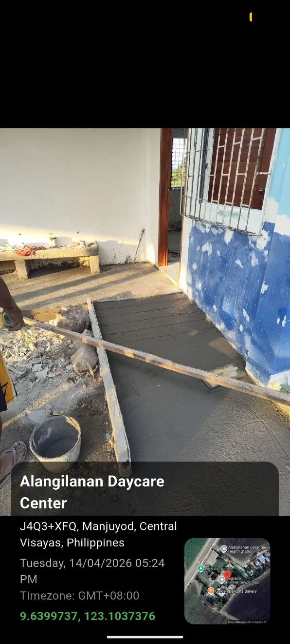
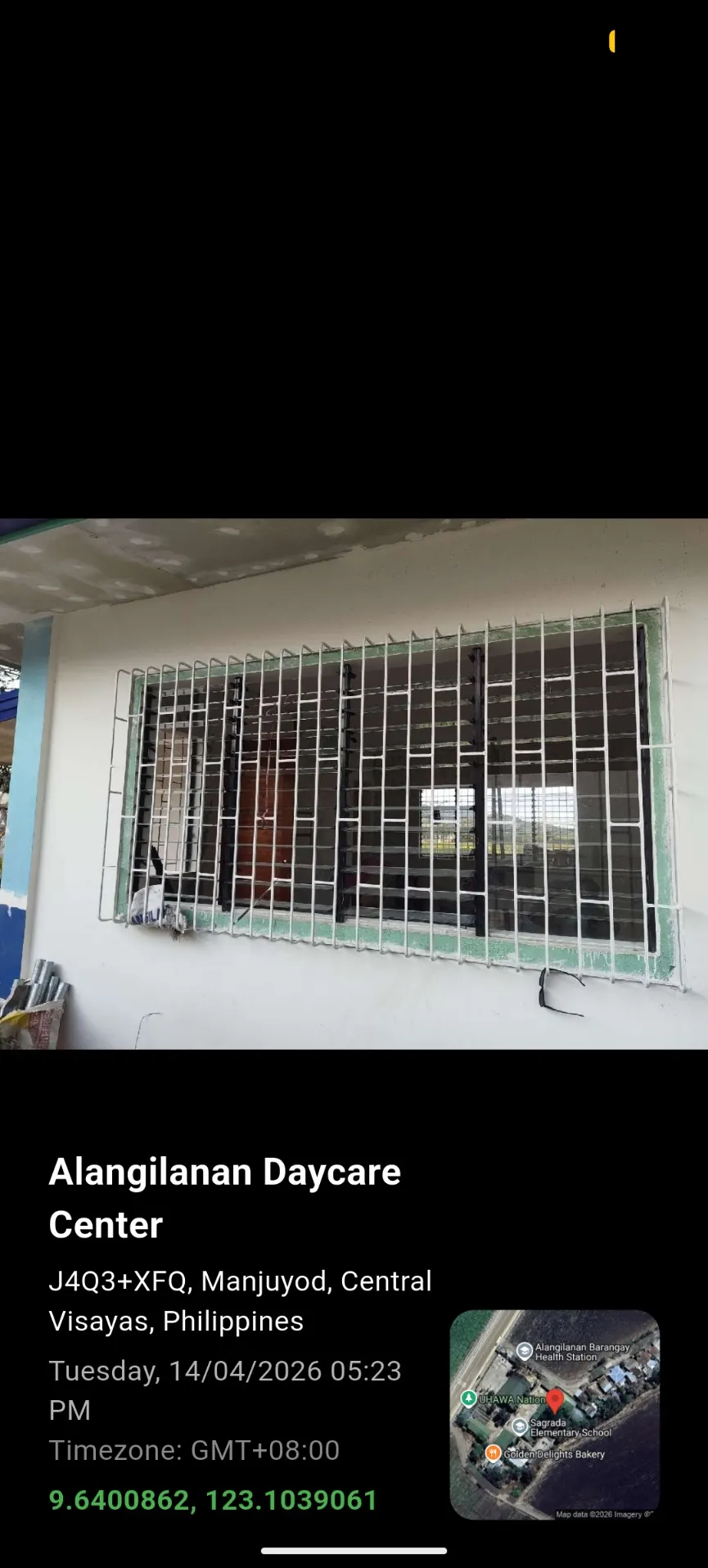
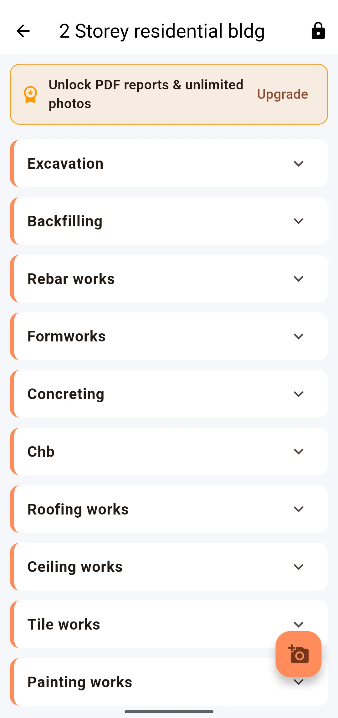
Projects are organized with custom work scopes you define per project — excavation, rebar, concreting, roofing, whatever breakdown matches how the work is actually billed or financed — and every photo files itself under the right scope automatically. Track scope completion percentage as you go, and when it's time to submit, generate a formatted PDF report in one tap.
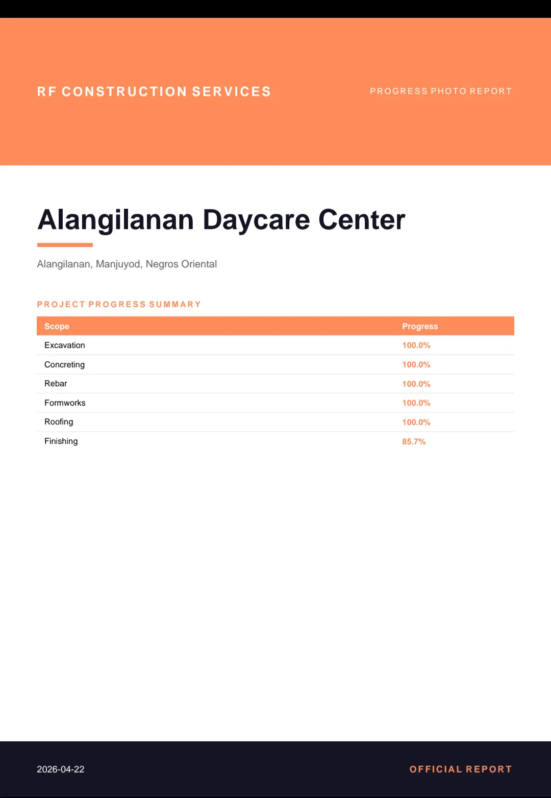
The report includes a cover page with the scope-by-scope progress table, a photo grid per scope with the map snapshot alongside each photo, and a closing sign-off page with signature lines — the same structure a bank or client reviewer expects to see, without you formatting it by hand:
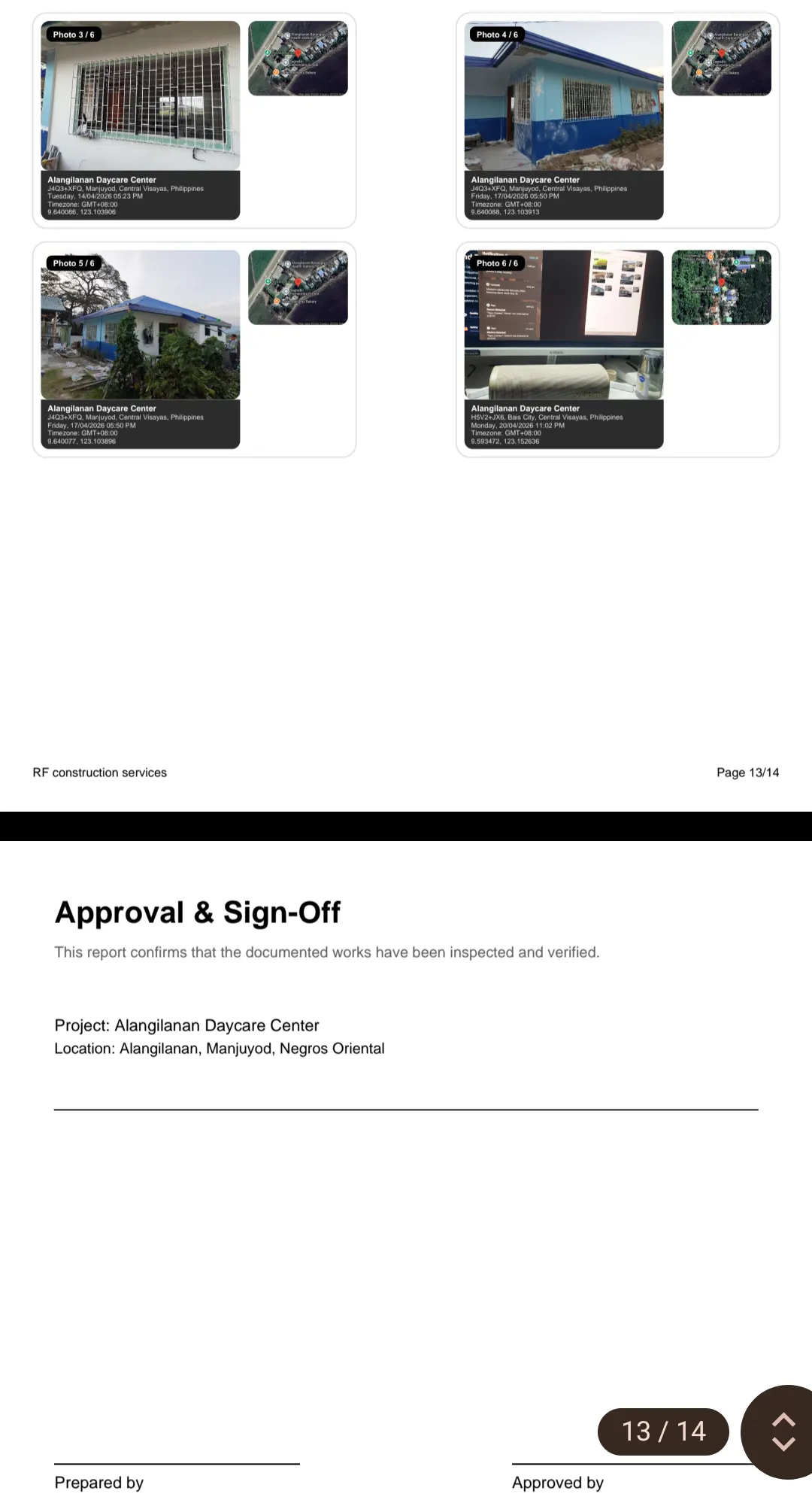
Photo capture and GPS stamping work on-site regardless of signal — the coordinates come from the device's GPS, not the network. Cloud sync and PDF generation happen once you're back online.
PhotoStruct GPS-stamps every site photo automatically — coordinates, map snapshot, date, and project name — organized by work scope, exported as a client-ready, signed-off PDF report in one tap.
AEDO Construction provides design-build project management for residential and commercial builds in Negros Oriental, and design plus remote construction oversight nationwide — structural design, permitting, and documented progress at every stage.